A marathon runner, diver, and part-time programmer, now lives and works both in Manila and Saigon Vietnam, used to live in BKK, Kyoto, Osaka, Zurich, Geneva, and Hanoi.
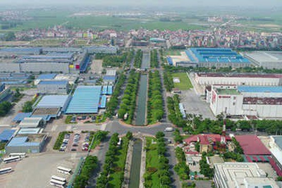
Places like home: Ecopark (VN), Katsura (JP), Geneva (CH), and Zurich (CH)
Currently working for - Arcadis (Duty station in Manila, Philippines) - Project Director and Procurement and Contract Specialist - Technical, Environmental & Commercial Due Diligence projects for Acquisition and Merging business in Southeast Asian Region - Water and Wastewater Treatment Plants and Distribution Networks. - Project Risk Analysis (including seismic risk analysis for computing maximum credible lost using FEMA and fragility curve approach) - Asset Management and Data Analytics (ISO 55000(1), statistical modelling, reliability analysis) - Institute of Smart City and Management (ISCM), UEH University, Vietnam - Senior Lecturer, Chair of Urban Analytics, Risk, and Asset Management - ASQ Vietnam Co. Ltd. - Founder and Business Advisor - EMAPTA as Technical Consultant
PhD in Applied Statistics and Mathematic Optimization for Asset Management of Buildings and Engineering Systems, 2009
Kyoto University, Japan
MEng in Construction Engineering and Management, 2004
Asian Insitute of Technology, Thailand
BA in Linguistics, 2002
Collegle of Foreign Language, National University of Vietnam
BEng in Civil Engineering, 2000
University of Transport and Communication, Hanoi
Lead Arcadis team in Saigon and local subcons to conduct TDD and design compliance review for 5 industrial sites in North and South of …
Review code compliance for 5 towers, 3 are in operation and 2 are under construction. TDD work encompases compliance verification for …
20 wastewater utilities of Manila Water has been accessed for their compliance with the new environmental standards (DAO2016). The team …
Conducting an extensive TDD work for a Global Capital Investment Firm, who wishes to take over the ownership of the bankrupted Hanjin …
Conducting an extensive TDD work for a Japanese Firm, who wishes to take over/share the ownership of the tower.
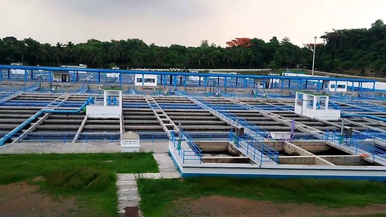
Rehabilitation, Retrofitting, and Process Improvement of Lamesa 2 Water Treatment Plant
Plant Audit and Asset Management for Various Pump Stations and Reservoirs
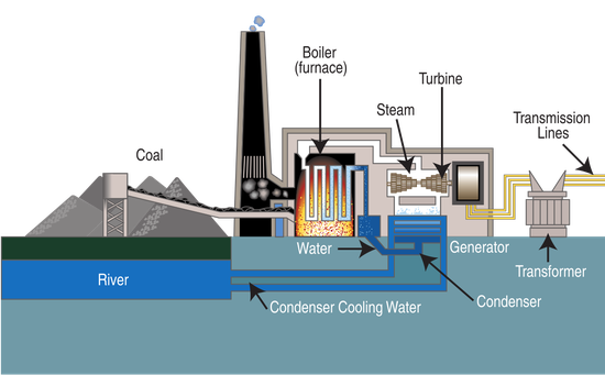
Feasibility Study for Pangasinan 900MW CFBC Power Station
A road network consists of multiple objects that deteriorate over time with different speeds of deterioration. In order to provide an adequate level of service over time, these objects will eventually require interventions. As road managers are trying, in general, to maximize the benefit obtained from the road network, it is in their interest to determine intervention programs, which consist of the grouping of interventions in work zones. The determination of optimal intervention programs is relatively complicated when considering single objects, but it becomes even more so when considering multiple objects embedded within a network. The objects to be included in the work zones at each time interval depend on many factors, such as the interventions to be executed on the objects, the maximum allowable length of the work zones, the traffic configurations to be used in the work zones and the available financial resources. Although some initial research in this area has been conducted, none has determined the optimal set of work zones on large infrastructure networks in a geographical information system (GIS) framework, which is necessary in the world of modern infrastructure management. In the work presented in this paper, a GIS-based program was developed to determine optimal intervention programs for large infrastructure networks using a linear optimization model, which can be linked directly to a GIS. The model includes constraints on the amount of available resources, on the length of the work zone, and on the distance between two work zones. A constraint-constructing algorithm is used in order to set up the latter two constraints. The program is illustrated by determining the optimal set of work zones for an example road network similar to the one in the canton of Wallis, Switzerland, including more than 2,000 bridges, tunnels, and road sections.
Many bridge management systems use Markov models to predict the future deterioration of structural elements. This information is subsequently used in the determination of optimal intervention strategies and intervention programs. The input for these Markov models often consists of the condition states of the elements and how they have changed over time. This input is used to estimate the probabilities of transition of an object from each possible condition state to each other possible condition state in one time period. A complication in using Markov models is that there are situations in which there is an inadequate amount of data to estimate the transition probabilities using traditional methods (e.g., due to the lack of recording past information so that it can be easily retrieved, or because it has been collected in an inconsistent or biased manner). In this paper, a methodology to estimate the transition probabilities is presented that uses proportional data obtained by mechanistic-empirical models of the deterioration process. A restricted least-squares optimization model is used to estimate the transition probabilities. The methodology is demonstrated by using it to estimate the transition probabilities for a reinforced concrete (RC) bridge element exposed to chloride-induced corrosion. The proportional data are generated by modeling the corrosion process using mechanistic-empirical models and Monte Carlo simulations.
The deterioration of a pavement surface can be described in terms of the presence and severity of distinct distresses, like potholes, cracking, and rutting. Each deterioration process is ordinarily described by a set of pavement indicators (e.g., number of potholes, percentage of cracks, international roughness index) that are measured during monitoring and inspection activities. Manifestly, there exist statistical correlations among the deterioration processes. For instance, cracks appearing on a road section may contribute to an increase in pothole occurrence, and vice versa. In order to mathematically formulate the statistical interdependency among deterioration processes, a Poisson hidden Markov model is proposed in this paper. The model describes the complex process of pavement deterioration, which includes the frequent occurrence of local damage (e.g., potholes) as well as the degradation of other pavement indicators (e.g., cracks, roughness). To model the concurrent frequency of local damage, a stochastic Poisson process is used. At the same time, a Markov chain model is used to depict the degradation of other pavement indicators. A numerical estimation approach using Bayesian statistics with a Markov chain Monte Carlo simulation is developed to derive the values of the model’s parameters based on historical information. The applicability of the model was demonstrated through an empirical example using data from a Japanese highway road link..